In 1932, two blocks of the Bwindi Impenetrable Forest were designated as Crown Forest Reserves. The northern block was designated as the “Kayonza Crown Forest Reserve”, and the southern block designated as the “Kasatora Crown Forest Reserve”. These reserves had a combined area of 207 square kilometres (80 sq mi). In 1942, the two reserves were combined and enlarged, then renamed the Impenetrable Central Crown Forest. This new protected area covered 298 square kilometres (115 sq mi) and was under the joint control of the Ugandan government’s game and forest departments.
In 1964, the reserve was designated as an animal sanctuary to provide extra protection for its mountain gorillas and renamed the Impenetrable Central Forest Reserve. In 1966, two other forest reserves became part of the main reserve, increasing its area to almost 321 square kilometres (124 sq mi). The park continued to be managed as both a game sanctuary and forest reserve.
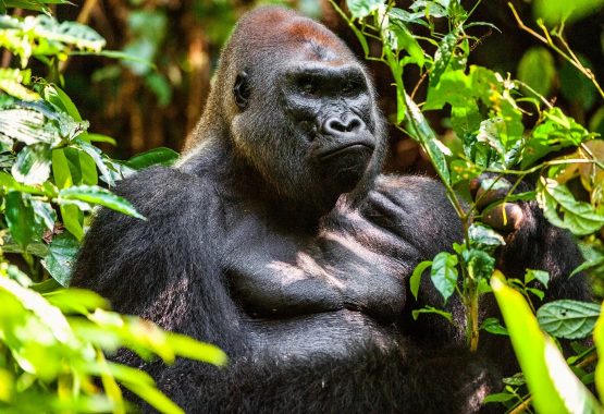
In 1991, the Impenetrable Central Forest Reserve, along with the Mgahinga Gorilla Reserve and the Rwenzori Mountains Reserve, was designated as a national park and renamed the Bwindi Impenetrable National Park. It covered an area of 330.8 square kilometres (127.7 sq mi). The national park was declared in part to protect a range of species within it, most notably the mountain gorilla. The reclassification of the park had a large impact on the Batwa pygmy people, who were evicted from the forest and no longer permitted to enter the park or access its resources. Gorilla tracking became a tourist activity in April 1993, and the park became a popular tourist destination. In 1994, a 10-square-kilometre (3.9 sq mi) area was incorporated into the park and it was inscribed on the World Heritage List.The park’s management changed: Uganda National Parks, since renamed the Uganda Wildlife Authority, became responsible for the park. In 2003 a piece of land next to the park with an area of 4.2 square kilometres (1.6 sq mi) was purchased and incorporated into the park.
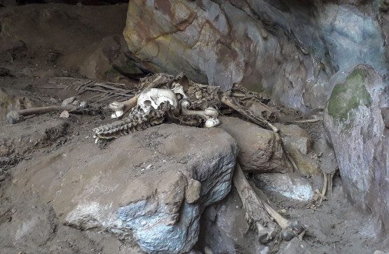
In March 1999, a force of 100–150 former Rwandan Interahamwe guerrillas infiltrated across the border from the DRC and kidnapped 14 foreign tourists and their Ugandan guide from the park headquarters, eventually releasing six and murdering the remaining eight with machetes and clubs. Several victims were reportedly tortured, and at least one of the female victims was raped. The Ugandan guide was doused with gasoline and lit on fire. The Interahamwe attack was reportedly intended to “destabilize Uganda” and frighten away tourist traffic from the park, depriving the Ugandan government of income. The park was forced to close for several months, and the popularity of the gorilla tours suffered badly for several years, though attendance has since recovered due to greater stability in the area. An armed guard also now accompanies every tour group.

Mountains of Bwindi
Kabale town to the south-east is the nearest main town to the park, 29 kilometres (18 mi) away by road. The park is composed of two blocks of forest that are connected by a corridor of forest. The shape of the park is a legacy of previous conservation management, when the original two forest blocks were protected in 1932. There is agricultural land where there were previously trees directly outside the park’s borders. Cultivation in this area is intense.
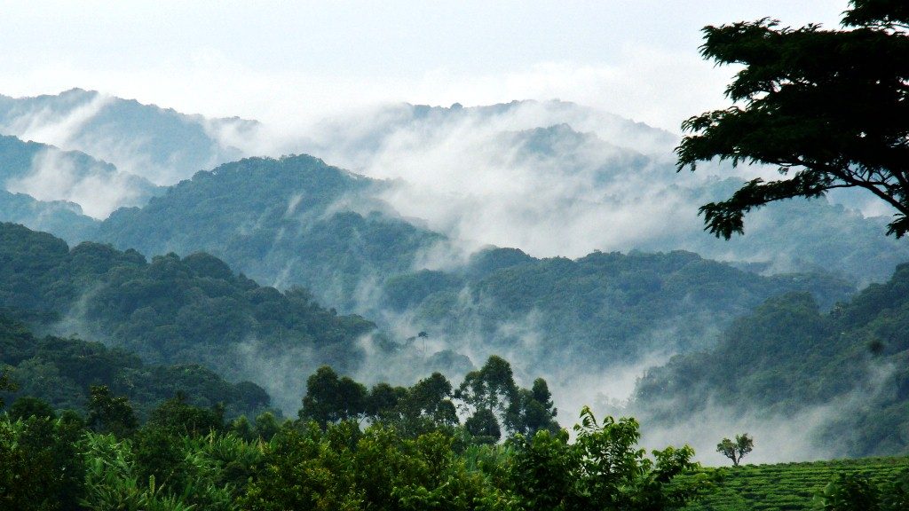
The park’s underlying geology consists of Precambrian shale phyllite, quartz, quartzite, schist, and granite. The park is at the edge of the Western Rift Valley in the highest parts of the Kigezi Highlands, which were created by up-warping of the Western Rift Valley. Its topography is very rugged, with narrow valleys intersected by rivers and steep hills. Elevations in the park range from 1,190 to 2,607 metres (3,904 to 8,553 ft) above sea level, and 60 percent of the park has an elevation of over 2,000 metres (6,600 ft). The highest elevation is Rwamunyonyi Hill at the eastern edge of the park. The lowest part of the park is at its most northern tip.
The forest is an important water catchment area. With a generally impermeable underlying geology where water mostly flows through large fault structures, water infiltration and aquifers are limited. Much of the park’s rainfall forms streams, and the forest has a dense network of streams. The forest is the source of many rivers that flow to the north, west, and south. Major rivers that rise in the park include the Ivi, Munyaga, Ihihizo, Ishasha, and Ntengyere rivers, which flow into Lake Edward. Other rivers flow into Lakes Mutanda and Bunyonyi. Bwindi supplies water to local agricultural areas.
Bwindi has a tropical climate. Annual mean temperature ranges from a minimum of 7 to 15 °C (45 to 59 °F) to a maximum of 20 to 27 °C (68 to 81 °F). Its annual rainfall ranges from 1,400 to 1,900 millimetres (55 to 75 in). Peak rainfall occurs from March to April and from September to November. The park’s forest plays an important role in regulating the surrounding area’s environment and climate. High amounts of evapotranspiration from the forest’s vegetation increases the precipitation that the region outside the park receives. They also lessen soil erosion, which is a serious problem in south-western Uganda. They lessen flooding and ensure that streams continue to flow in the dry season.